Searching for a location
How to find a location, what loads automatically, and how to set the analysis radius.
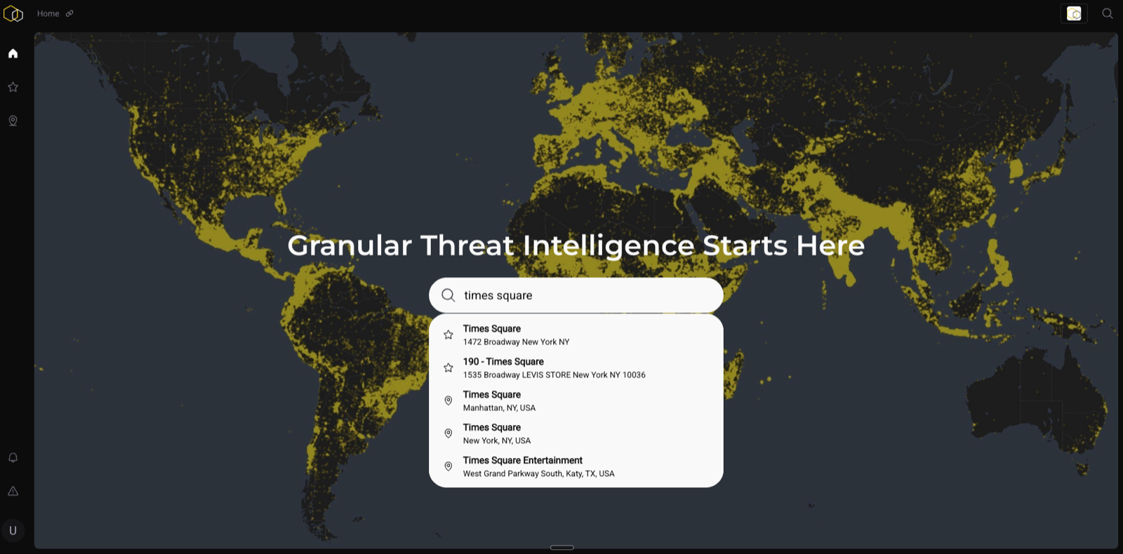
Using the Search Bar
Click the search bar at the top of the map and type any of the following: - A street address - A city or neighborhood name - A saved location name from your portfolio
The platform will center the map on that location and automatically load risk data within the default radius.
What Loads Automatically
When you land on a location, you'll see: - The BaseScore for that location and radius - A visual representation of event data on the map - The analytic panel on the right populating with breakdowns
Adjusting the Radius
Use the radius control to expand or contract the area of analysis: - 0.1 mi — immediate site perimeter - 0.25 mi — standard site-level view - 0.5 mi — walkable surroundings - 1 mi — broader neighborhood context
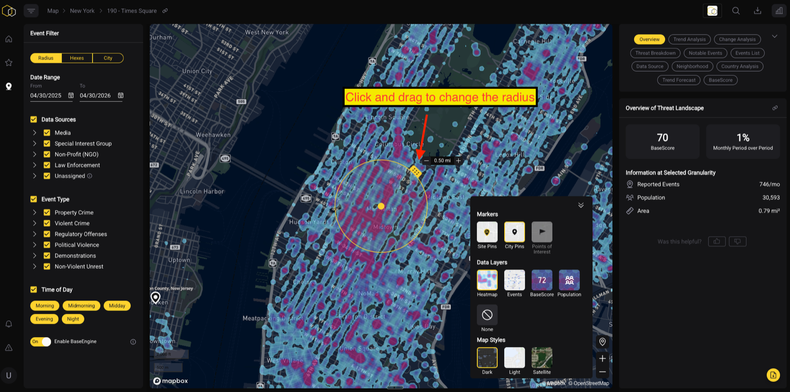
Tip: Start at 0.25–0.5 miles for most site assessments. Use 1 mile when you want neighborhood-level context or are comparing multiple nearby locations.